Math 21a: section knill Fall 2022
21a Fall 2022

Ocean Map
 A map of the ocean was completed late. Only in the 1960ies,
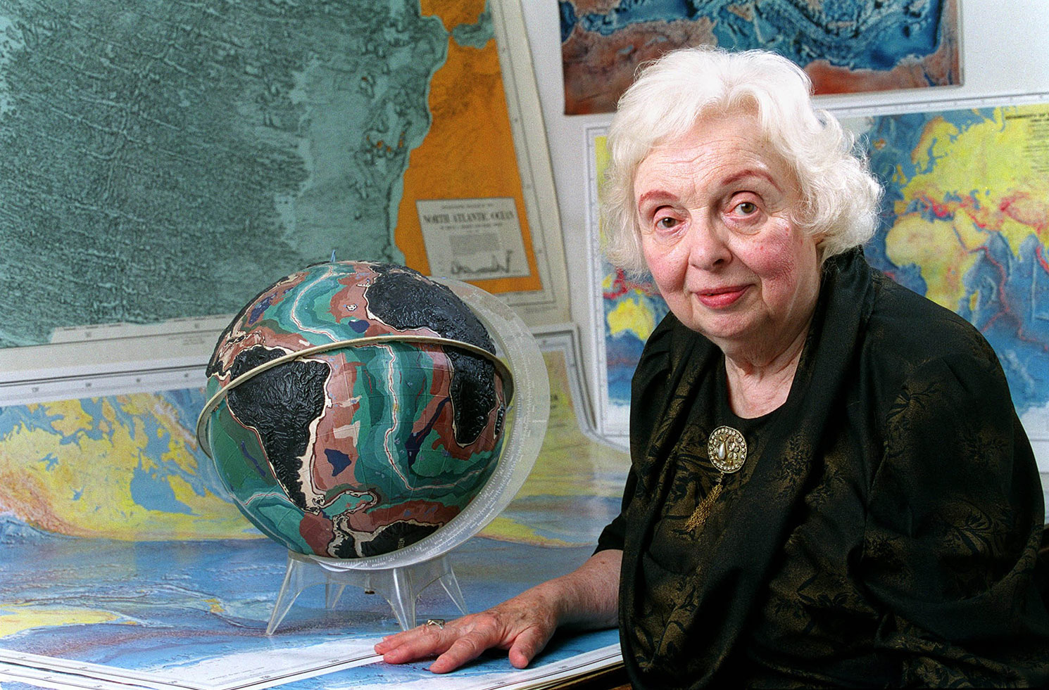
Google of November 21 featured geologist Marie Tharp, a geologist and cartographer. A version of the Heezen-Tharp
World ocean floor map is
in the Library of congress. It was hand-painted 1977 by Heinrich Berann based on a map by
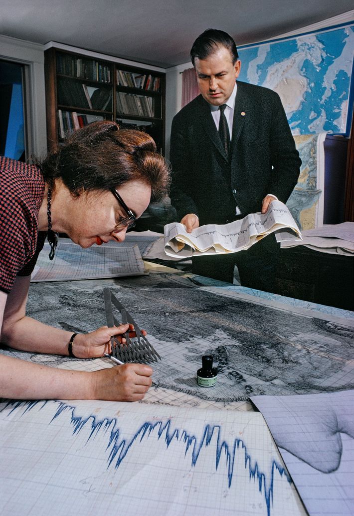
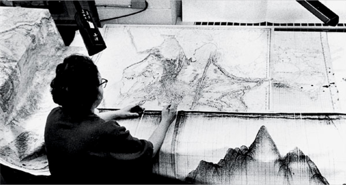
Bruce Heezen and Marie Tharp (1920-2006)
The story is told here in the Woods hole oceanographic institute.. The maps were initially unpublished
in the Cold War for fear that Soviet submarines could use them. The maps turned out to be important for getting rid of the
expanding earth hypothesis and supporting the continental drift theory. It is an example, where a single function f(x,y) of
two variables helped to understand a basic geological feature of the earth. There were other indicators like exact
distance measurements between different points in different continents.
A map of the ocean was completed late. Only in the 1960ies,
Google of November 21 featured geologist Marie Tharp, a geologist and cartographer. A version of the Heezen-Tharp
World ocean floor map is
in the Library of congress. It was hand-painted 1977 by Heinrich Berann based on a map by
Bruce Heezen and Marie Tharp (1920-2006)
The story is told here in the Woods hole oceanographic institute.. The maps were initially unpublished
in the Cold War for fear that Soviet submarines could use them. The maps turned out to be important for getting rid of the
expanding earth hypothesis and supporting the continental drift theory. It is an example, where a single function f(x,y) of
two variables helped to understand a basic geological feature of the earth. There were other indicators like exact
distance measurements between different points in different continents. 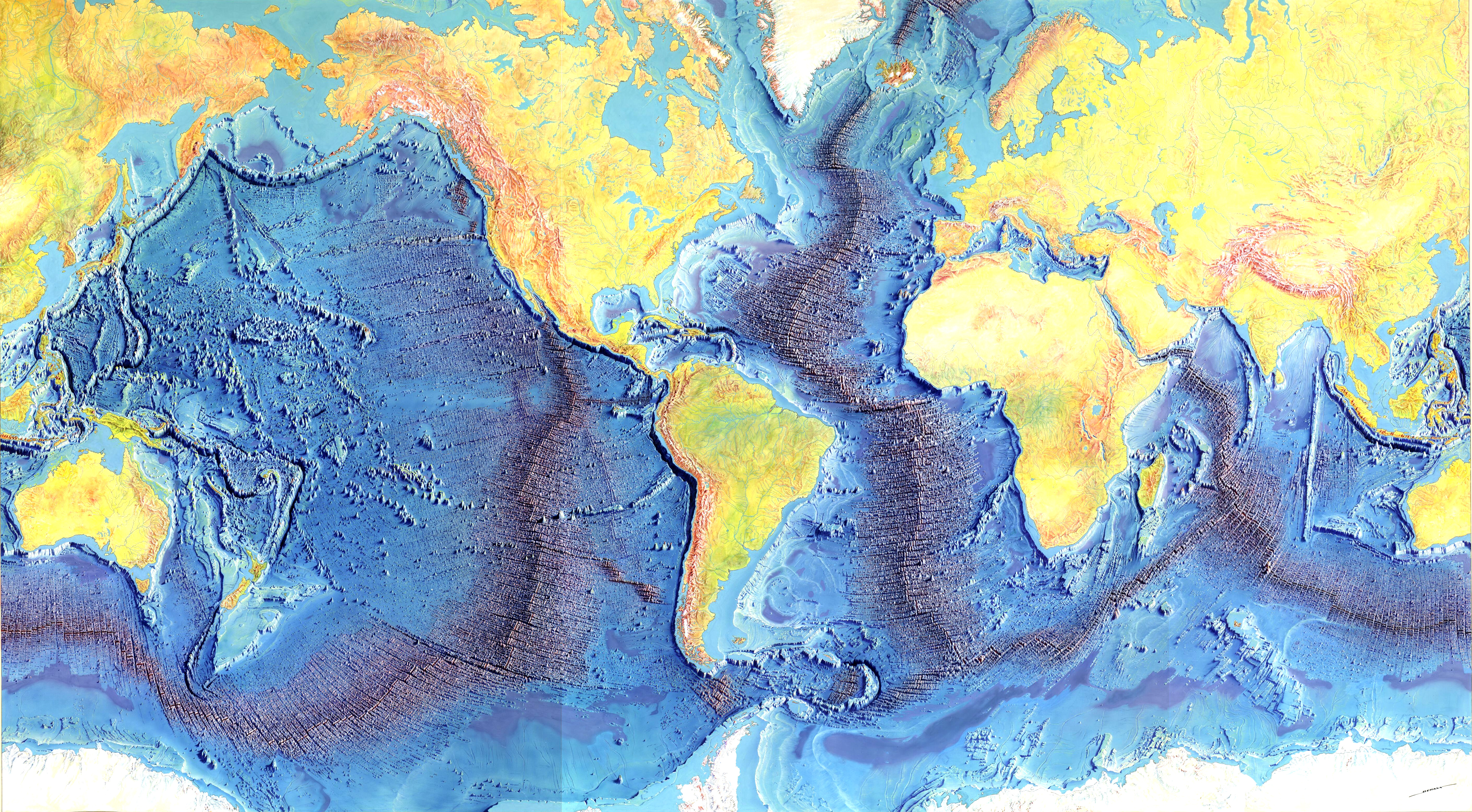
Click for a larger figure. The map is found at many places, like here at the univeristy of Chicago or at Wikipedia. We enhanced the source map a bit with brightness and contrast and removed the gaps from scanning and also clipped the boundary.
Amazing how the original maps were drawn with ink. Here is a picture from a Blog of Derya Gürer or this page.